Custom search

Samstag, 22. Juni 2013

Natura 2000 network of protected areas - a delaunay triangulation point of view

Natura 2000 is the centrepiece of EU nature & biodiversity policy. It is an EU wide network of nature protection areas established under the 1992 Habitats Directive. The aim of the network is to assure the long-term survival of Europe's most valuable and threatened species and habitats. It is comprised of Special Areas of Conservation (SAC) designated by Member States under the Habitats Directive, and also incorporates Special Protection Areas (SPAs) which they designate under the 1979 Birds Directive. [1]

In Austria, a discussion about the (in)completeness of the protected area network is ongoing [2].

Let's have a simple look at the network properties of the Austrian Natura 2000 protected areas done by GRASS GIS [3]

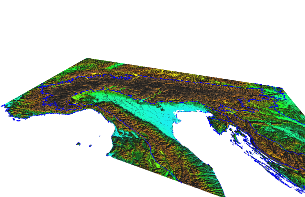
GIS data: SRTM [4], Natura 2000 data – the European network of protected sites - status end 2011 [5], European countries [6]

colored srtm:

r.colors map=srtemgar@gar color=srtm

extract centroid of Natura 2000 protected areas:

v.extract input=n2knewtwork output=n2knewtwork_centroid type=centroid

delaunay triangulation of centroids:

v.delaunay -l input=n2knewtwork_centroid output=n2knewtwork_centroid_delaunay


The delaunay triangulation of Natura 2000 protected area centroids in Austria is less densed compared to surrounding countries. 

So some additions may indeed be necessary to include all habitats and species of European interest.


[1] EU 2013. Natura 2000 network.
http://ec.europa.eu/environment/nature/natura2000/

[2] Umweltdachverband 2013. Zukunft Natura 2000 – Raus aus dem Schatten! Available at: http://www.umweltdachverband.at/service/veranstaltungsnachlese/jahrestagung-2013/

[3] GRASS GIS 2013. Version: 6.4.3svn, SVN Revision: 56757 Available at: http://grass.osgeo.org/

[4] CGIAR-CSI 2008. SRTM 90 m Digital Elevation Data. Available at: http://srtm.csi.cgiar.org/

[5] EEA 2012. Natura 2000 data – the European network of protected sites. European Environment Agency. Available at: http://www.eea.europa.eu/data-and-maps/data/ds_resolveuid/60860bd4-28d6-44aa-93c7-d9354a8205e3

[6] Eurostat 2013. Administrative units and Statistical units. Available at: http://epp.eurostat.ec.europa.eu/portal/page/portal/gisco_Geographical_information_maps/popups/references/administrative_units_statistical_units_1

Samstag, 2. März 2013

All about alpine rivers - a sort of ...

These days I've found a nice GIS datatset of alpine rivers in Tyrol (running waters as vector lines, many point informations like hydropower plants, sources etc.). Moreover the dataset is creative commons licensed (Attribution 3.0 Austria (CC BY 3.0 AT)).


Data source: Land Tirol - data.tirol.gv.at (GIS: GRASS GIS; DEM: SRTM)

Maybe it's already out there, it would be fine to have such a detailed river/hydro dataset for the entire Alps, particularly as a base for an open minded discussion about new hydropower plants nowadays.

And keep the idea of sustainable water use in the sense of the Alpine Convention (1, 2, 3, 4, 5, 6) , Natura 2000 and Water Framework Directive in mind.

Natura 2000 and land cover changes - how to manage?

Natura 2000 is the centrepiece of EU nature and biodiversity policy. It's an EU-wide network of protected areas established under the Habitats Directive and Bird Directive.

The Corine programme (Coordination of Information on the Environment) has established a computerised inventory on the land cover (100x100m) in Europe and delivers summaries for the period 1990-2000 and 2000-2006.

Some analysis results by intersecting the Natura 2000-protected areas and lande cover changes in Austria for these two periods (processed in GRASS GIS).

1990 - 2000: 122 km2 land cover change within Natura 2000-protected areas Austria


Natura 2000-sites and landcover changes 1990-2000 (DEM: SRTM)

  • Glacier and perpetual snow to open spaces with little or no vegetation: 72,6%
  • Non-irrigated arable land, pastures, natural grassland and land principally occupied by agriculture, with significant areas of natural vegetation to artificial surfaces: 6,2%
  • Non-irrigated arable land, pastures to forest: 1,7%

2000 - 2006: 63 km2 land cover change within Natura 2000-protected areas in Austria


Natura 2000-sites and landcover changes 2000-2006 (DEM: SRTM)
  • Glaciers and perpetual snow to open spaces with little or no vegetation: 53,3%
  • Non-irrigated arable land, pastures, natural grasslands and land principally occupied by agriculture, with significant areas of natural vegetation to artificial surfaces: 3,6%
  • Pastures and natural grassland to forests: 0,8%

We are currently witnessing a steady loss of biodiversity (1) (2). Land cover/use and biodiversity are connected, especially in the cultural landscape (3). As shown by the results, two main drivers for such changes can be identified: changes in "natural"/physical factors (e.g. temperature, preciptation - climate change) and human activities.

The European Commission adopted the EU biodiversity strategy 2020 to halt the loss of biodiversity and ecosystem services in the EU by 2020.

Protected areas may be considered as nucleus of a sustainable development, though common trends of landuse changes (associated with influence on biodiversity) seems to occur also inside.

How to manage these processes (4) (5) (6)?


Freitag, 1. Februar 2013

mystery...

Mystery what the two previous posts are for? Actually there are some (non)discussions (1)(2)(3) about the implementation of international legal frameworks for nature protection and sustainability in Austria.

It is worth just to read sometimes the frameworks' text (Habitat Directive: EN, DE; Alpine Convention: EN, DE), there are wise and interesting thoughts ...

Montag, 28. Januar 2013

awareness

"aware that the Alps are one of the largest continuous unspoilt natural areas in Europe, which, with their outstanding unique and diverse natural habitat, culture and history, constitute an economic, cultural, recreational and living environment in the heart of Europe, shared by numerous peoples and countries,"

"im Bewusstsein, dass die Alpen einer der grössten zusammenhängenden Naturräume Europas und ein durch seine spezifische und vielfältige Natur, Kultur und Geschichte ausgezeichneter Lebens-, Wirtschafts-, Kultur- und Erholungsraum im Herzen Europas sind, an dem zahlreiche Völker und Länder teilhaben,"

Sonntag, 27. Januar 2013

an essential objective of general interest...


"Whereas the preservation, protection and improvement of the quality of the environment, including the conservation of natural habitats and of wild fauna and flora, are an essential objective of general interest pursued by the Community, as stated in Article 130r of the Treaty;"

"Wie in Artikel 130r des Vertrages festgestellt wird, sind Erhaltung, Schutz und Verbesserung der Qualität der Umwelt wesentliches Ziel der Gemeinschaft und von allgemeinem Interesse; hierzu zählt auch der Schutz der natürlichen Lebensräume sowie der wildlebenden Tiere und Pflanzen."
 

Samstag, 26. Januar 2013

This new blog will be about

nature (e.g. Natura 2000)

Biogeographical regions, Europe 2011 – Rev 1. (EEA 2012, DEM: SRTM, GIS: GRASS )

sustainability (e.g. Alpine convention)
Perimeter Alpine Convention (BGBl. Nr. 477/1995, DEM: SRTM, GIS: GRASS)

 Spatial thinking may be the link.